
Historic Winchester map framed and available now!
Our historic map of Winchester has been beautifully framed by Francis Frith, the UK’s leading publisher of local photographs and maps. Handmade in their Wiltshire workshop, Francis Friths’ innovative framing allows for the first time seamless access to both sides of the Winchester map, whilst retaining a stylish finish.
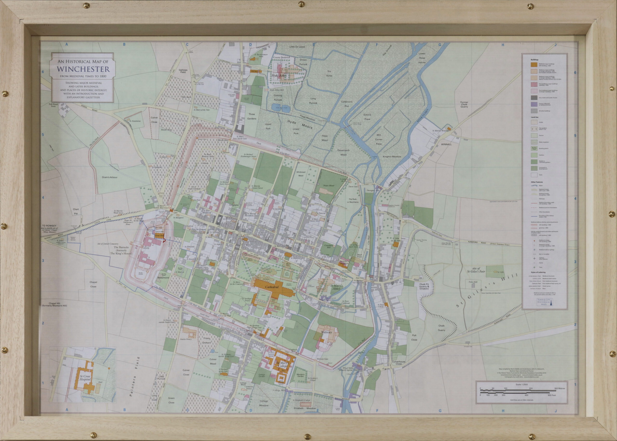
The original version of the Winchester Map was published in collaboration with the Historic Towns Trust, with a revised edition made available in 2016: https://www.winchesterstudies.org.uk/publications/the-winchester-excavations-committee-and-the-british-historic-towns-atlas-an-historical-map-of-winchester-from-medieval-times-to-1800/.
The map (as supplied to Francis Frith now as a flat sheet) details Winchester’s remarkable history, from its time as the royal and ecclesiastical centre in Anglo-Saxon England, to the city known by Jane Austen. Featuring the historic map on the facing side, and a gazetteer of Winchester’s most important buildings and sites on the reverse, it’s a fantastic guide to this ancient city.
We are thrilled that our collaboration with Francis Frith has produced such a unique product, the purchase of which will provide the focus for many interesting observations on Winchester’s past.
For further information, and to purchase please visit https://www.francisfrith.com/winchester/maps
*You'll find our map toward the bottom of the first page.

